 |
| 1705 ca. «The Sea Coast of Valencia and Catalonia with the Island of of Maiorca, Menorca and Iviça», Cartògraf: Samuel Thorton, The New York Pubic Library. Un preciós mapa acolorit de la costa dels Països Catalans gairebé completa. Aquest cartògraf era d'origen anglès, membre d'una nissaga dedicada durant els segles XVII i XVIII a la representació cartogràfica. |
 | ||
| 1705 ca. «The Sea Coast of Valencia and Catalonia with the Island of of Maiorca, Menorca and Iviça», Cartògraf: Samuel Thorton, The New York Pubic Library. La representació de la costa del Principat, una mica massa plana i rectilínia, però interessant en algun dels detalls.
|
 |
| 1705 ca. «The Sea Coast of Valencia and Catalonia with the Island of of Maiorca, Menorca and Iviça», Cartògraf: Samuel Thorton, The New York Pubic Library. La ciutat de Barcelona amb el moll i el port. Mataró a l'un costat, Montjuïc a l'altre. La desembocadura del Llobregat amb el Garraf i, potser, Cubelles. |
 |
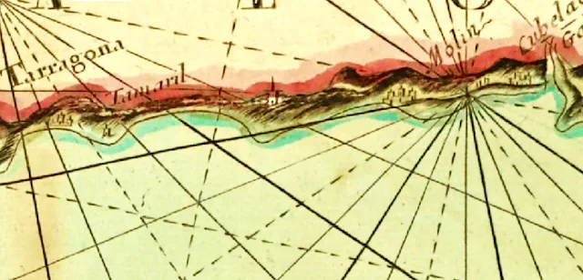
| 1705 ca. «The Sea Coast of Valencia and Catalonia with the Island of of Maiorca, Menorca and Iviça», Cartògraf: Samuel Thorton, The New York Pubic Library. La costa central fins a Tarragona. El castell de Tamarit ben visible. |
 |
| 1705 ca. «The Sea Coast of Valencia and Catalonia with the Island of of Maiorca, Menorca and Iviça», Cartògraf: Samuel Thorton, The New York Pubic Library. La Costa Daurada de fa tres-cents anys, des del Cap de Salou fins al Delta. Entremig, la torre de Miramar de Mont-roig, la torre dels Penyals (actualment a Miami), la riera de Llastres amb l'Hospital de l'Hospitalet, i el castell de Sant Jordi un cop superat el Coll de Balaguer. Pràcticament fins a l'Ampolla, un territori poc poblat, inhòspit, ventós i difícil per al viatger. |
 |
| 1705 ca. «The Sea Coast of Valencia and Catalonia with the Island of of Maiorca, Menorca and Iviça», Cartògraf: Samuel Thorton, The New York Pubic Library. El delta de l'Ebre en formació. La punta de la Banya i el port dels Alfacs, ja ben formats, però la punta del Fangar encara representada com una illa. Més avall, Vinaròs, Benicarló i Peníscola en sa particular península. |
 |
| 1705 ca. «The Sea Coast of Valencia and Catalonia with the Island of of Maiorca, Menorca and Iviça», Cartògraf: Samuel Thorton, The New York Pubic Library. La costa valenciana, amb el Túria ben marcat i el port del Grau, però sense l'albufera. |
 |
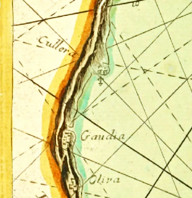
| 1705 ca. «The Sea Coast of Valencia and Catalonia with the Island of of Maiorca, Menorca and Iviça», Cartògraf: Samuel Thorton, The New York Pubic Library. Detall de Cullera, Gandia i Oliva. |
 |
| 1705 ca. «The Sea Coast of Valencia and Catalonia with the Island of of Maiorca, Menorca and Iviça», Cartògraf: Samuel Thorton, The New York Pubic Library. Detall de Dénia i Xàbia, i del Cap de la Nau, dit aleshores de Sant Martí. |
 |
| 1705 ca. «The Sea Coast of Valencia and Catalonia with the Island of of Maiorca, Menorca and Iviça», Cartògraf: Samuel Thorton, The New York Pubic Library. Les Balears i les Pitiüses, poc proporcionades. |
 |
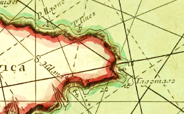
| 1705 ca. «The Sea Coast of Valencia and Catalonia with the Island of of Maiorca, Menorca and Iviça», Cartògraf: Samuel Thorton, The New York Pubic Library. Detalls d'Eivissa i Formentera. Amb una àncora s'hi marquen els diferents ports naturals que permetien als vaixells de resguardar-s'hi. |
 |
| 1705 ca. «The Sea Coast of Valencia and Catalonia with the Island of of Maiorca, Menorca and Iviça», Cartògraf: Samuel Thorton, The New York Pubic Library. L'illa de Mallorca i principals ports naturals. |
 |
| 1705 ca. «The Sea Coast of Valencia and Catalonia with the Island of of Maiorca, Menorca and Iviça», Cartògraf: Samuel Thorton, The New York Pubic Library. Detalls de la costa mallorquina. |
 |
| 1705 ca. «The Sea Coast of Valencia and Catalonia with the Island of of Maiorca, Menorca and Iviça», Cartògraf: Samuel Thorton, The New York Pubic Library. L'illa de Menorca, amb el gran port de Maó i l'ermita de Fàtima de Favàritx, amb el nom afrancesat de Nostra Dama de Tour. |
 |
| 1705 ca. «The Sea Coast of Valencia and Catalonia with the Island of of Maiorca, Menorca and Iviça», Cartògraf: Samuel Thorton, The New York Pubic Library. Detalls del port de Maó i del port natural de Fornells. |


